Java Private Experiences
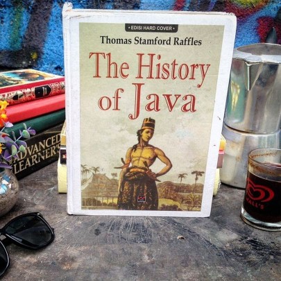
On October 21, 1785 or hundreds of years before Mount Merbabu was designated a national park, a Dutch East Indies naturalist and scientist, Francois van Boekhold, is said to have reached Kopeng, which is the northern side of Mount Merbabu. But before that, Boekhold, departed from Salatiga, Central Java, on horseback and arrived at Kopeng, in the afternoon around 5 pm. At 8 pm according to him, the temperature was already very cold. Until he could penetrate his woolen warm clothes, and it was impossible for him to remain silent without fire as a warmer. In a hut (a traditional house made of pottery), according to Boekhold, a Javanese man was seen sitting in a hut near the fireplace, and that same night, he was inspecting the north, east and southeast of the mountain, which he thought looked good and amazing. As stated by Francois van Boekhold, in his notes, Relaas van een togt den Brandenden Berg op Java (Story of Journey to Volcano in Java), published by Verhandelengin van het Bataviaasch Genootschap den Kunsten en Weternschappen or Society for Arts and Sciences, the oldest scientific institution in Southeast Asia in 1792. So, from various records and sources, the mountains in Indonesia, since hundreds of years ago, have indeed been climbed by Europeans and Dutch East Indies. The naturalists, nature lovers and researchers, not only climb, but also make notes about the characteristics and things about the mountain that he climbed.
As retold by Friedrich Franz Wilhelm Junghuhn a naturalist, doctor, botanist and geologist from the Indies born in Prussia Germany, in his famous book, Java (1850 dan 1854), Boekhold, departed from Salatiga, early in the morning, on October 21, 1785. Arrived at Kopeng in Central Java around the afternoon. Then, at midnight, Boekhold, began to climb through the dense and dark forest, he was accompanied by several local residents who were hired to help bring supplies and equipment, when time showed 3 am, Boekhold, with the help of Compass navigation tools, took the road stretching to the southeast, cutting through dense and dark forests using Booman or machetes, he opened the path to find the path to the summit. The trees he saw at that time were large and the temperature was very cold.
According to Boekhold, although he was not aware of the existence of the slightest wildlife, but with a gun, he had fired several times for the Tigers or Javanese Tigers. At 5 am, the air is getting cold. Then, an hour later, Boekhold came out of the woods and arrived at a small plain, at six o'clock, the cold was like freezing, he said. I was so cold that it was hard to talk and my feet and hands froze. The place is very pleasant, like being in a flower garden, he said. There is full of overgrown grass that is very short and full of flowers, very similar to Rosemary flowers. At least more than one hundred plants which according to him, he did not yet know the type. Then, Boekhold, continue to climb. Increasingly high, the barren mountain, until finally arriving at the top of Mount Merbabu, at 10 o'clock in the morning. Wide enough, full of grass, shrubs and large cliffs. At that time, the weather at the peak was very sunny. So, Boekhold can see the surrounding scenery. Such as : highlands Kedu, Demak, to the north and south seas. "It's really fun," he said. For several hours, Boekhold, remained silent, resting at the peak. During that time, none of the wild animals he found. When reading the minutes of his journey, Francois van Boekhold, who described the atmosphere of thick and dark forests, is still a bit confusing. Did he pass through the two official climbing routes in Gunung National Park as currently in Kopeng, namely the Cuntel route and the Tekelan path. However, from his treatise, Boekhold, wrote the word Thontil. Where, he arrived there at 6 pm. As told before, at 8 pm, the air was very cold there. He also saw a resident sitting near the fireplace in his house. Well, maybe what Thontil meant here is Cuntel Village. The small plain that Boekhold tells of a pleasant place and a mountain peak that is almost as high as the plains, it seems, at this time is the Kedokan Post heading to the Kergo Pasar Pos, the Cuntel route. The peak of the mountain that Boekhold said, as I remember when climbing through the Cuntel route, was Mount Telomoyo, Mount Andong and several other mountains. When viewed from the small plain, the height is almost the same.
Meanwhile, Friedrich Franz Wilhelm Junghuhn, one of the great naturalists and researchers of the Dutch East Indies, on November 7, 1836, climbed Mount Merbabu, through the south side, Selo. According to Junghuhn, He climbed for 5 hours, then headed towards the northeastern peak. There was hail at that time, where the temperature dropped quickly enough, and became very cold. The following morning, before sunrise, Junghuhn descended through the northeast side. According to him, the terrain is like a uniform from the other side. Then, arriving at one of the highest villages at the foot of Mount Merbabu, the name is Diwa Village, if you check the map, the name of the village still exists today, but now the name is Diwak. On May 2, 1838, Junghuhn ascended Mount Merbabu again, But this time, hike through the east side of the mountain, Pantaran village, if you check the map, Pantaran Village, enter Ampel District. Now, this village is famous as a religious tourism destination. While climbing, Junghuhn, tells of Mount Merbabu which consists of several peaks. He said several fumaroles and mud wells, but no eruptions.
Merbabu Mountain Private Trail
The Mount Merbabu Hiking Trail is a 17.3 kilometer walking path, administratively Mount Merbabu is in the province of Central Java, and is located in four regencies, for the west slope is in Magelang regency, and for the east and south slopes into the Boyolali Regency area, and for the northern slopes it enters the Semarang Regency area. Mount Merbabu is a volcano that is close to the city of Jogjakarta, and because of its close location, Mount Merbabu is a highland that is perfect for viewing Mount Merapi which is currently active, there are 2 general routes to the top of Mount Merbabu, namely north from Kopeng or Tekelan, and south from Selo Village.
Recommended only for very experienced adventurers, the hiking trails feature exotic wildflowers, and a wide choice of challenging trails, and the best weather for an adventure on Mount Merbabu is from March to October.
Written by : Edu – Java Private Tour
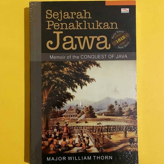
Source : various historical sources and literature, Relaas van een togt den Brandenden Berg op Java, Java.
*Click HERE to get to know Java Private Tour more closely
You May Also Like
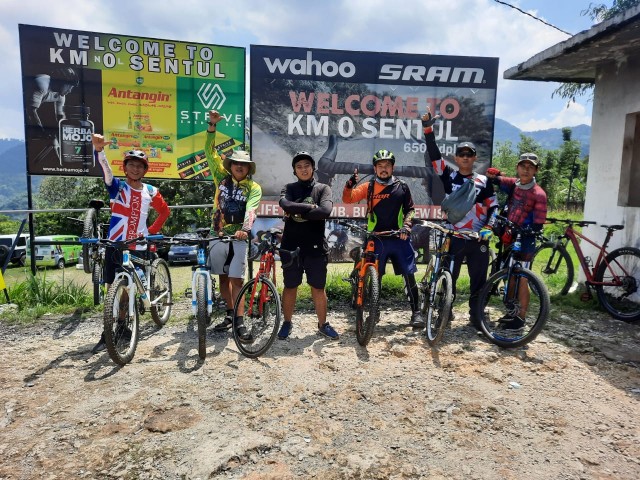
 A Story From Our Friends All Over the World in the Middle of a Pandemic
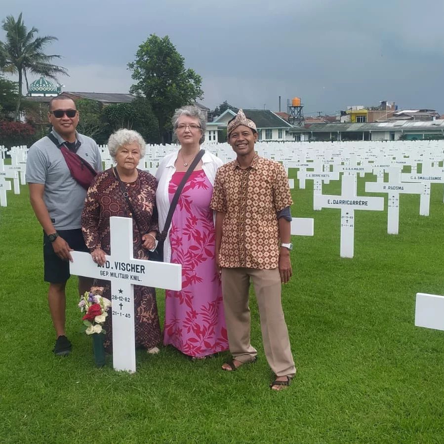 Journey to the Past: Unveiling Your Ancestors’ Graves in Indonesia
 Ijen Crater Volcano That Spewed Blue Lava
 Beyond Borders: A Unique Road Trip with Java Private Tour’s Tourism Buses for Transportation in Java and Bali
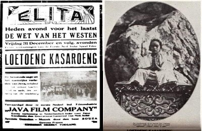 First film in Java-Indonesia